 |
|
 |
|
And Vacation , Know the real Mexico !!!!!
Mexico Mexique Mexico trips vacations trekking hikking expeditions Mountain guides outdoor adventure mexico hiking
Guias de Montaña Montañismo campismo liderazgo viajes transporte renta de autos guias de turismo alternativo rescate cursos rappel rapel escalada en roca Oaxaca Puebla Ajusco Pico de Orizaba espeleoligia espeleismo Chontacoatlan Chonta ixtaccihuatl malinche malintzi nevado de toluca teotihuacan cantona cholula iglesias turismo de aventura amecameca videos leyendas trabajo en equipo
CULTURAL TRAVEL, VACATIONS, TRIPS ,TREKK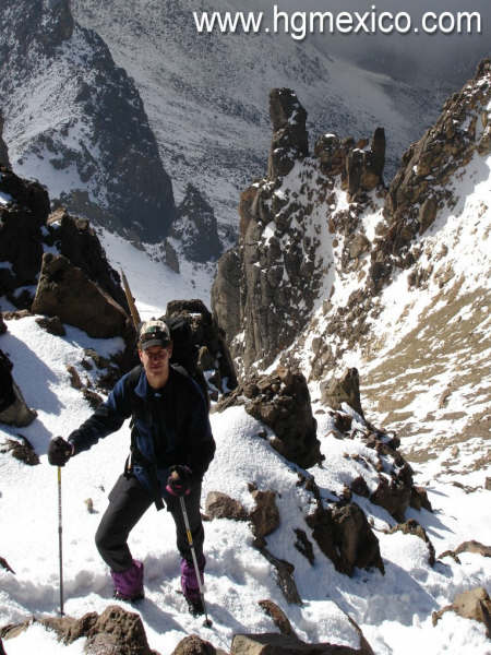 ING
ING
, EXaPEDITIONS, CLIMBING, MEXICO MOUNTAIN GUIDES AND MORE. season 2008-2
(all the pictures in this site, were done in our activities)
Welcome to Mexico Mexico Volcanoes Expedition, trekking, trips
Guide di Montagna di Messico, pietra che si arrampica e più, viaggi e spedizioni, tutti fanno Lei ha bisogno
Mexiko Berg Führer, Stein, der klettert, und mehr, Reisen und Expeditionen, alle machen, Sie brauchen
Orizaba Mountain Guides mexico's volcanoes, adventures around mexico city, outdoors and tripscultural places, interesting things in mexico
Orizava Mountain Guides,
Climbers at Mexico
Outdoors Mequiqeu
Pico de Orizaba Mountain Guides
Mexico Mountain Trips
Mexico Expeditions
Éxpediciones en México
Mexique
Le mexique est un vaste pays connaissant, déjà depuis longtemps, une importante activité touristique. En ce qui concerne le relief, on peut diviser le Mexique en deux parties à l'Est et à l'Ouest de la dorsale centrale faite de hauts volcans couronnées de neige et qui traversent le pays d'Est en ouest, un peu au Sud de Mexico. Le Nord du mexique, fait de hauts plateaux, est dominé par la Sierra Madre, qui est le prolongement des montagnes rocheuses américaines.mexiko.
Le Mexique est de peu d'intérêt pour ce qui et de l'alpinisme classique, on peut cependant y pratiquer la descente et l'exploration de magnifiques canyons (Yucatan) ainsi que la spéléologie. Ce seront donc, essentiellement, les grands volcans de la région de Mexico qui pourront intéresser les amateurs d'ascensions faciles. Le plus élevé de ces volcans est le Citlaltepeti (5699 m), il est situé à l'Est et domine la ville de Veera cruz (Veracruz). les plus connus sont le Popocatepetl (5450 m) et l'Ixtaccihualt (5326 m) au dessus de Puébla. ces géants sont assoupis mais bien d'autres sont actifs, le seul état de Michoacan en compte 80. Le Mexique se trouve, en effet, sur une zone instable de l'écorce terrestre "la ceinture de feu" péri-pacifique, où les secousses telluriques sont fréquentes
type="text/javascript" language="JavaScript"> </SCRIPT><NOSCRIPT></NOSCRIPT>
http://counter.Sports.bpath.com//statc.dll/M=7809&S=sp&Counter=1">
Transportation, climbing, pico de orizaba, mountains Mexico, Mexican volcanoes, volcano, popocatepetl, iztaccihuatl, ixtaccihuatl, izta, citlaltepetl, orizaba peak, rj, secor, Everest training, trips all include, professional guides, Malinche, ajusco, nevado de toluca, rappel, rescue, trekking, hiking, equipment, maps, travel , expeditions mexico, typical culture, friends, woman climbing, food information, logistic, alpinism, mounting, courses, Acapulco, puebla, veracruz, guerrero, touristy information, climber, pyramids, teotihuacan, Aztecs, caves, , vidales reyes enterprise, company, club, organization Alaska mountain guides , school,. vacations, beach, Connect - Mexico's monthly ezine / magazine devoted to informing about and promoting Mexico, her people, culture, history, arts, business and ..
Rock and mountain climbing expeditions in Mexico. Courses, guides and excursions at any level. ... General Information - High Mountain Climbing. Mexico has eight mountains clasified in the 'Perpetual Ice' category. ...
.ECO TRAVELS IN MEXICO. Mexico Mountain Sports Guide. Mountaineering, Rock Climbing and Trekking ...
Mexico OnLine sports directory, on the web's most popular Mexico resource. ... The complete and independent online guide to Mexico, plus Accommodations, Activities, Business, Culture, Real Estate ...
Climbing the Volcanos of Mexico
Article with photo images by Richard Ferguson of Boulder Colorado, about climbing the volcanos of Mexico - Pico de Orizaba (Citlateptl) 5700m 18700ft, Popocatepl 5452m 17887ft and Iztaccihuatl, ... CLIMBING VOLCANOS IN MEXICO. An article by Richard Ferguson, Boulder, Colorado
bergsteiger, Beiblatt zum Reisefuhrer von Mexico.hinweise zur vorbereitug vor der reise und zu
Orizaba's Peak
ontañas y pirámides en 16 días
our mountains and trips (transportation, mountain guides, hotel, huts , base camp, hikking trekking , outdoors ,
Pico de Orizaba
Pico de Orizaba Volcano / Nahuatl name: Citlaltepetl (Mount of the Star)
19.030 N, 97.268 W
Stratovolcano
18871 ft.
(Orizaba Peak)
--------------------------------------------------------------------------------
Pico de Orizaba is the fourth highest volcano in the Northern Hemisphere.
Eruptions of Pico de Orizaba Volcano
1687, 1630, 1613, 1569, 1566, 1545-65?, 1537
With an altitude of more than 5750 m (18871 ft.,) it is the highest inactive volcano in Mexico. Situated between the states of Puebla and Veracruz, it is cone-shaped and has a crater with a depth of 300 m and a width or 400 m.
The Aztecs believed that the divine fire from Orizaba's crater consumed a great winged serpent, Quetzalcoatl. Then Quetzalcoatl, the god of learning and the priesthood, took the form of a man and sailed across the sea, swearing to return and seek vengeance on the Aztec nation.
From the summit there is an excellent view of other mountains, such as, Iztaccihuatl, Popocatépetl (an active volcano,) la Malinche, and Cofre de Perote.
The base shelter can be reached using 4x4´s to weave through a forest of coniferous trees. Above the shelter there is a an area that is ideal for camping for those who require greater acclimatisation to altitudes exceeding 4000 m. By way of the north route the ascent crosses a glacier known as Jamapa, which leads to the crater. From the crater it is necessary to ascend to the summit by circling the cone-shaped apex.
_______________________________________________________________________________
Popocatepetl Volcano
Mexico
On December 1994 was close by the vulcanic activity,
if you want climb near you can see our trips in www.hgmexico.com
19.023 N, 98.622 W
summit elevation 5426 m
stratovolcano
Popocatepetl is currently the highest active volcano in the Northern Hemisphere.
On 29th Janaury 2001 pyroclastic flows travelled 8 km from Popocatepetl Volcano causing glacial melting.
Eruptions of Popocatepetl Volcano
1996-2003, 1994-95, 1947, 1942-43, 1933, 1923-24, 1920-22, 1852, 1827-34, 1802-04, 1720, 1697,
1663-67, 1642, 1592-94, 1590, 1580, 1571, 1548, 1542, 1539-40, 1530, 1528, 1519-23?, 1518, 1512?,
1509?, 1504, 1488, 1363, 1354, 1345-47
Popocatepetl whose name is the Aztec word for smoking mountain, towers to 5426 m 70 km SE of Mexico City to form North America's 2nd-highest volcano. The glacier-clad stratovolcano contains a steep-walled, 250-450 m deep crater. The generally symmetrical volcano is modified by the sharp-peaked Ventorrillo on the NW, a remnant of an earlier volcano. At least three previous major cones were destroyed by gravitational failure during the Pleistocene, producing massive debris-avalanche deposits covering broad areas south of the volcano. The modern volcano was constructed to the south of the late-Pleistocene to Holocene El Fraile cone. Three major plinian eruptions, the most recent of which took place about 800 AD, have occurred from Popocatepetl since the mid Holocene, accompanied by pyroclastic flows and voluminous lahars that swept basins below the volcano. Frequent historical eruptions, first recorded in Aztec codices, have occurred since precolumbian time.
Left: Photo taken by the American Landsat satellite on 27 Dec. 1980. The area shown is about 30 km wide (~20 miles), and the smallest object visible is about 30 m across. A long mountain range is in the center of the picture. The dark parks are covered by forests. Popocatepetl is the volcano near the bottom of the range, and the white, snow-covered ridge near the middle is Iztaccihuatl, another volcano which has not erupted during the last few thousand years. Near the top is Tlaloc, a much older volcano that is extinct.
Right: Enlargement of the Popocateptl part of the first one. If you look closely you can see the crater at the top of Popocateptl. The eruptions are coming from within the crater. Do you wonder what the black pluses are on these images? They are not giant marks on the ground, but are tiny, equally spaced marks on the satellite camera. If there are any distortions in a satellite image, scientists can check the distances between the pluses to make correction. Most satellite cameras don't have these pluses - or fiducial marks, as they are called.
Volcanic Explositivity Index: 1-2
Popocatepetl, the second highest volcano in Mexico, is a giant stratovolcano, 70 km (~45 miles) southeast of downtown Mexico City, and 45 km (~30 miles) southwest of the city of Puebla.
Popo - as many people call it rather than struggling with its full name (Popo-cat-e-petal) - became active just before Christmas after five decades of quiet. During the last two years the volcano has frequently had a small column of steam rising from its summit crater. After midnight on December 21, 1994 a series of earthquakes signaled that eruptions had started. That morning a gray ash cloud was visible over the top of the volcano, and ash fell on Puebla.
During the afternoon, the eruptions increased. Because most of the ash was blowing to the east, civil defense authorities decided to evacuate 19 villages (31,000 people) east of Popo. Moderate eruptions have continued, and according to newspapers the total number of evacuees was about 75,000 people by December 26. The United States Geologic Survey has sent a team of volcano experts to Mexico to help Mexican scientists evaluate what the volcano may do in the near future. The volcano has been quite for more than a week now.
Background Information:
Popo is one of the most active volcanoes in Mexico, having had 15 eruptions since the arrival of the Spanish in 1519 AD. The Aztec Indians who lived in Central Mexico recorded additional eruptions in 1347 and 1354. Most of the eruptions in the past 600 years were relatively mild, with ash columns rising only a few kilometers above the summit.
Volcanologists have studied Popo because most volcanoes tend to have future eruptions that are like their earlier ones. Thus, the volcano's past history helps us prepare for possible future activity. One very important reason to try to predict future eruptions is that more than 20 million Mexican people live close enough to the volcano to be threatened by its eruptions.
________________________________________________________________________
Iztaccihuatl Volcano (Sleeping Lady 5,256m)
Mexico
19.179 N 98.642 W
Stratovolcano
Holocene eruptions
Commonly referred to as “The Sleeping Lady”, Iztaccihuatl has an altitude exceding the limit of 5000 m above sea level. The mountain forms the profile of a woman with her head, breasts, and feet as the main formations.
There are various routes with altitudes for different levels, from beginners to very experienced mountaineers. All of the routes provide excellent training for those wishing to achieve greater acclimatisation to high altitude mountaineering.
The landscape is incredible and ever-changing as you ascend. It is a mountain with beautiful and varied vistas, such as a spectacular view of Mexico State, Puebla, and Mexico City.
The summit (the breasts) is covered with glaciers – glaciers that are charged with energy and inspire reflection. It is said that those who descend from the summit achieve a certain degree of illumination and strength of life.
_______________________________________________________________________________
NEVADO DE TOLUCA (4 680 M; 15,354 FT)
This is Mexico´s fourth highest mountain, after the Pico de Orizaba, Popocatépetl, and Iztaccíhuatl. (By some measurements, however, the Sierra Negra is slightly higher.) , and it is unique in taht one can drive into the crater of this volcano, Nevado de toluca has two summits, the higher Pico de Fraile (Friar´s Peak) at 4 680 meters
It is often called Xinantécatl, which is probably from the Nahuatl chinām(itl) 'cornstalks' + tēcatl 'lord of', though other etymologies have been suggested. It is an extinct volcano located in central Mexico. This volcano has its higher summit at 4577 metres and in good weather it is clearly visible from the Mexican city of Toluca. An unusual feature of this mountainous formation is the existence of two lakes in small extinct craters within the caldera, the cold water Sun Lake and the Moon Lake. A road runs into the caldera, making this perhaps the most accessible major Mexican peak.
IF YOU WANT CLIMB WITH US, ARE MANY OPTIONS VISIT OUR SECTIONS "TRIPS"; TRIPS WITMEALS; THE TRILOGY, FOUR MOUNTAINS , ETC.
Fecha
Día 5 Montañas y pirámides en 16 días
Actividad
Hospedaje /
Alimentos incluidos
B Desayuno /
L comida / D cena
Nov 21 1 Arribo a la ciudad de México traslado al hotel día libre (2250m) (hotel en el centro histórico)
6 pm Hotel en Ciudad de México
D
22 2 Visita a las pirámides de Teotihuacan, traslado al DF Hotel en Ciudad de México B
23 3 mañana libre en la ciudad y a la tarde traslado a la refugio del Ajusco Albergue del Ajusco
D
24 4 Ascenso al Ajusco (3840m)
Traslado al refugio del nevado de Toluca B/D
Campamento o Refugio Nevado de Toluca
25 5 Ascenso a la Cumbre primera del Nevado de Toluca (4600m) Campamento o Refugio Nevado de Toluca
B/L/D
26 6 Traslado a Xochimilco (Venecia Mexicana)
Traslado al refugio de la Malinche (3008m) Cabañas
B/D
27 7 Ascenso a la Malinche 4400m Cabañas Malinche
B/L/D
28 8 Traslado al pueblo Amecameca de ahi a Paso de Cortez o Refugio altzomoni en auto 3950 m Campamento o refugio Altzomoni
B/L/D
29 9 Traslado a la Joya Ascenso a la Cumbre “las rodillas (5050) si el grupo se encuentra bien a la cumbre la panza o el Pecho (5254m) traslado a Cholula (2400m) Cholula Hostal
B/L/D
30 10 Día libre en Cholula pueblo típico con pirámides y ,muchas Iglesias Cholula Hostal
B/D
Diciembre
1 11 Traslado a la Ciudad de Oaxaca día libre (Famosa Ciudad cultural) Hotel en la ciudad de Oaxaca B
2 12 Visita a las pirámides de Monte Alban, tarde libre Hotel en la ciudad de Oaxaca B
3 13 Traslado al pueblo Tlachichuca (2600m) traslado en vehiculo 4x4 al refugio Piedra Grande (4200m) Campamento o refugio Piedra Grande B/L/D
4 14 Ascenso a la cumbre Pico de Orizaba (5754m) traslado en 4x4 a Tlachichuca Tlachichuca hotel sencillo para escaladores
B/L/D
5 15 Visita a las piramides de Cantona Hostal en Cholula
B/L/D
6 16 Traslado a la ciudad de Mexico , fin de servicios
B/
7 17 Dia Extra
Visita a la Piramide del Cerro de La estrella
Comida en casa de una familia tipica mexicana
Traslado al Aeropuerto L
Member of U.I.A.A. Union International of Alpine Associations / National Sports Confederation (Mexico) - Mexican Federation of Mountainnering Sports & Climbing - National commission of Mountain Rescue (Mexico)
CULTURAL TRAVEL, VACATIONS, TRIPS ,TREKKING, EXPEDITIONS, CLIMBING, MEXICO MOUNTAIN GUIDES AND MORE. season 2008-2009
(all the pictures in this site, were done in our activities)
Orizaba , Iztaccihuatl, Popocatepetl, Malinche, Nevado de Toluca Mexico Mountain Guides, Piramyds
Some choices we have :
1 Day Trekk
My First Expedition
Iztaccihuatl and Pico de Orizaba Expedition (6 days)
The Trilogy (Malinche, Iztaccihuatl and Pico de Orizaba)
Four Mountains Expedition (Nevado de Toluca and Trilogy)
Four mountains and Tipycal Places Expedition (12 days)
TREKK IN FOUR MOUNTAINS AND TIPYCAL PLACES (15 days)
trips for all levels.......
TRIPS ALL YEAR
here you can find information of the mexican mountains, expeditions in Mexico, rock climbing places , caverns, Oaxaca, pyramids, chichenitza, Cancun, Chiapas, Puebla, Toluca and more, Mexico's volcanoes, outdoor, outside of Mexico city, adventures around of Mexico,
"The last expeditions"
herzlich willkommen in Mexico Mekisiko e yookoso kangei
Bienvenu au Mexique! welcome to Mexico
phones in Mexico city:
0155 32 68 84 43
( 04455)11 39 86 35 mobil
____________________________________________________________________________________
Teotihuacan
Teotihuacan is a enchanting place of enormous pyramids, ruins, underground tunnels, murals, and ancient history. Visiting this ancient city will transport you into one of the most famous and intriging cultures of Mexico.
History
The Pyramid of the Moon "Teotihuacán" translated as "city where men become gods." According to legend it was where the Gods gathered to plan the creation of man.
The Construction of Teotihuacán commenced around 300 BC, with the Pyramid of the Sun built by 150 BC. The city reached its zenith approx. 150–450 AD, when it was the center of an influential culture. At its height the city covered over 30 km² (over 11½ square miles), and probably housed a population of over 150,000 people, possibly as many as 200,000. Teotihuacán was an important source of obsidian and there was extensive trade with other regions of Mesoamerica.
The city's broad central avenue, called "Avenue of the Dead" (a translation from its Nahuatl name Miccaohtli), is still flanked by impressive ceremonial architecture, including the immense Pyramid of the Sun (second largest in the New World after the Great Pyramid of Cholula), the Pyramid of the Moon, the Temple of Quetzalcoatl or Temple of the Feathered Serpent, and many lesser temples and palaces.
Site map on location at TeotihuacánThe Aztec named those pyramids according to their own beliefs, but the "Sun pyramid" was really dedicated to Tlaloc, and was built over a cave, probably considered sacred. Unfortunately the cave content was stolen, possibly in prehispanic times. The Moon pyramid was dedicated to Tlaloc´s consort Chalchihuitlicue and was used also as a burial site for important people.
Unfortunately no ancient Teotihuacano non-ideographic texts are known to exist (or known to have existed), but the city is occasionally referred to in the texts of Maya monuments, showing that Teotihuacán nobility travelled to and married with the families of local rulers as far away as Honduras. Maya hieroglyphs mention an individual nicknamed by scholars as "Spearthrower Owl", apparently Emperor of Teotihuacán, who reigned for over 60 years and imposed his relatives as kings of Tikal and Uaxactun in Guatemala. Most of what we infer about the culture at Teotihuacan comes from the murals that adorn the site and others, like the Wagner Murals, found in private collections.
It was previously believed that sometime during the 7th or 8th centuries, the city was sacked and burned by invaders, possibly the Toltecs. More recent evidence, however, seems to indicate that the burning was limited to the structures and dwellings associated primarily with the elite class. The slums and poorer districts were almost untouched. Many now claim this is evidence that the burning was from an internal uprising and that the invasion theory is flawed due to the fact that early archaeological work on the city was focused exclusively on the palaces and temples, places used by the elites, and because all of these sites showed burning. Archaeologists concluded that the whole city was burned. Instead, it is now known that the destruction in the city was focused on the power symbols: Some statues seem to have been destroyed in a methodical way, their fragments dispersed. The fact that population began to decline around 500-600 A.D. also supports the internal unrest hypothesis.
In rebuttal, advocates of the invasion hypothese point to the mural paintings of Cacaxtla, a rival city, in which was found a battle painting featuring the glyph of Teotihuacan over a burning pyramid, the Mesoamerican symbol of a conquered city, which could mean that there really was an attack on Teotihuacan, led by Cacaxtla. However, it was not unknown for ancient rulers to falsely claim victory over foes
This place has it´s own magic, energy, and culture.
Welcome to Quetzalcoatl land!