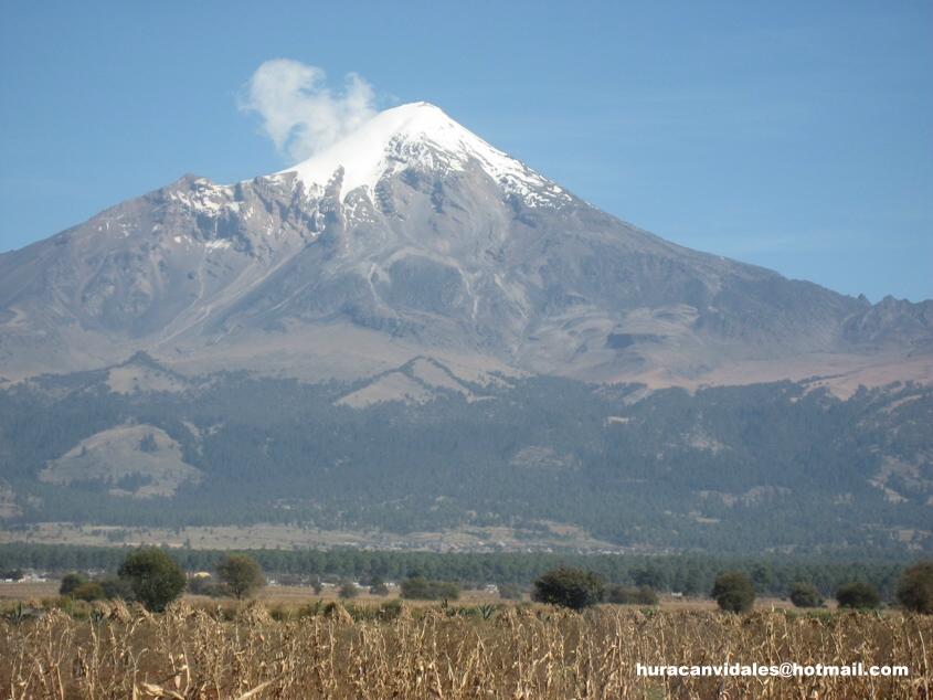
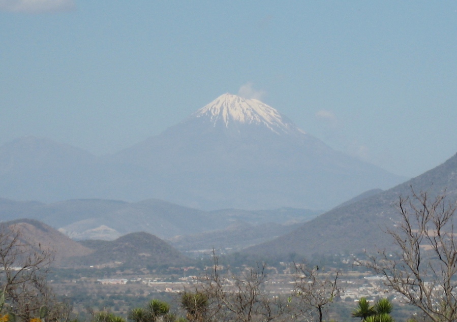
Pico de Orizaba Volcano in Mexico
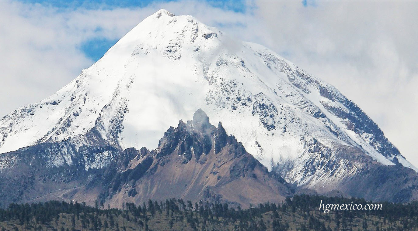
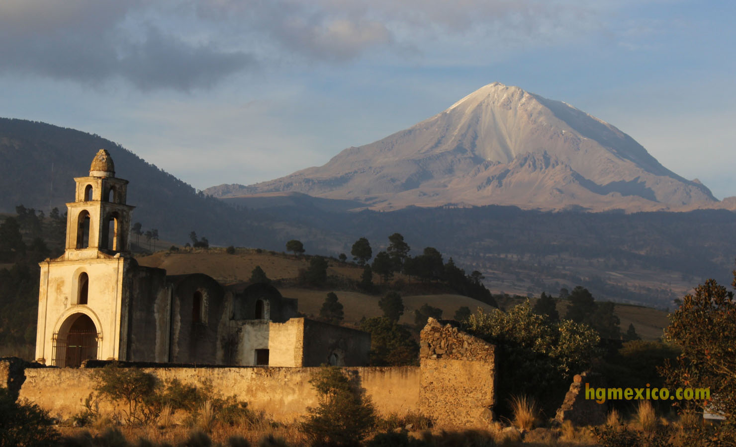
Photo: Pico de Orizaba from Tezmalaquilla (south Face) , on the left the "Large Telescope" at the Sierra Negra
Nahuatl name: Citlaltepetl also Poyauhtecatl = Mount of the Star (Orizaba Peak)
19.030 N, 97.268 W
Stratovolcano
18871 ft.
Pico de Orizaba is the third high mountain in Nort America fourth highest volcano in the Northern Hemisphere.
Eruptions of Pico de Orizaba Volcano
1687, 1630, 1613, 1569, 1566, 1545-65?, 1537
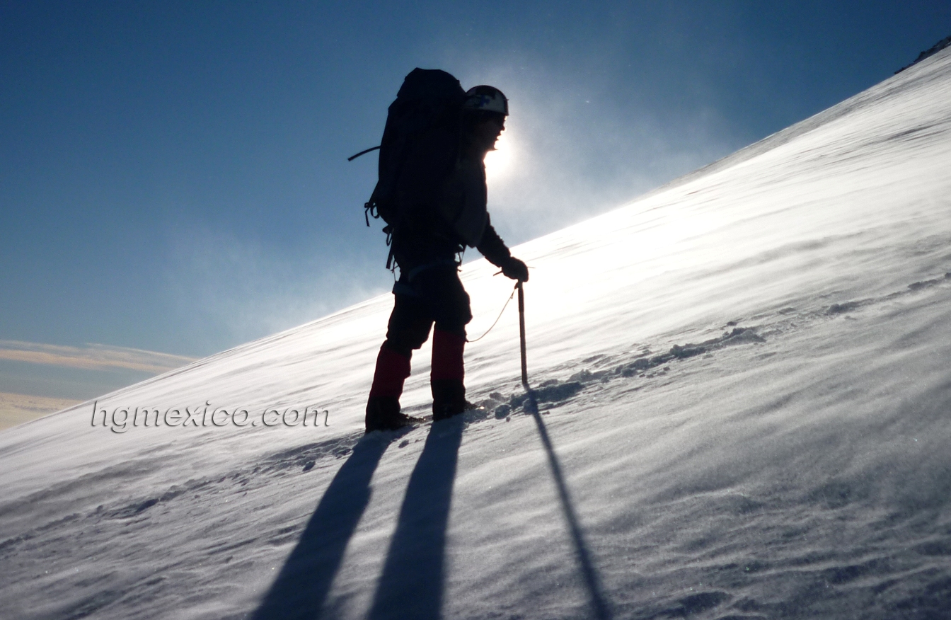
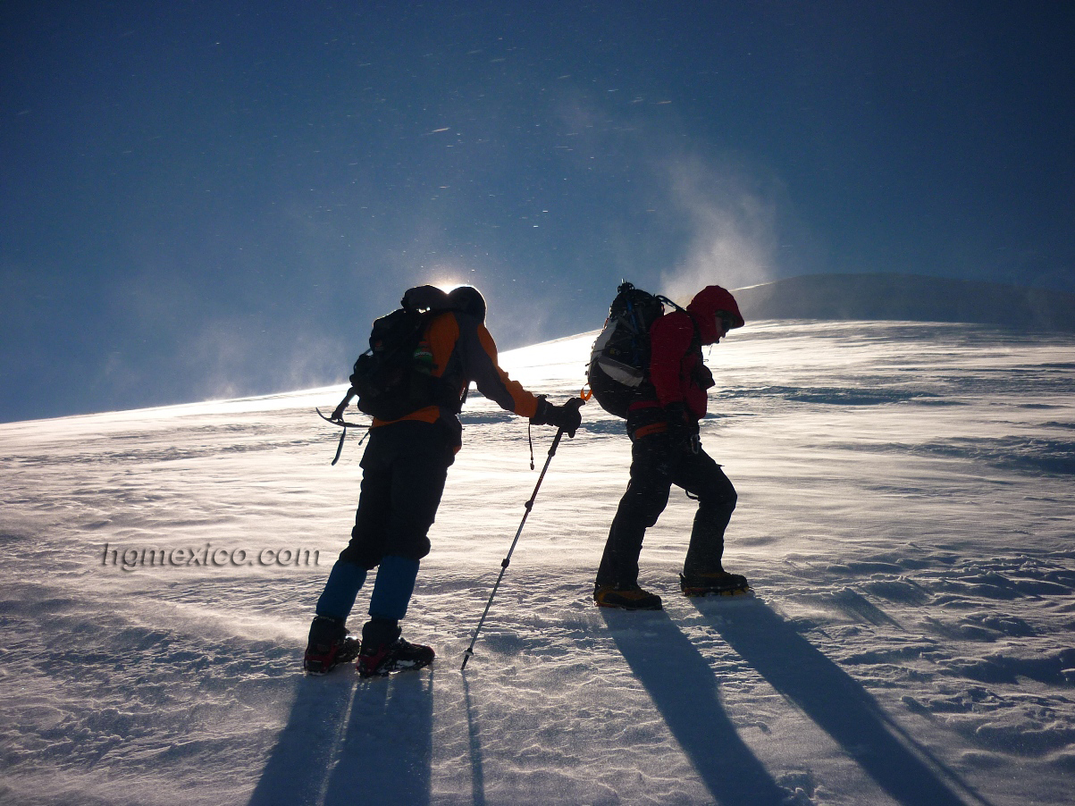
Pico de Orizaba Hiking
The route:
Since 5 years Ago is better climbing for the South Face.
Choices for climb el Pico de Orizaba
The good choice for climb el Pico de Orizaba with acclimatization is
PICO DE ORIZABA and IZTACCIHUATL
If you have more time and want know good places
PICO DE ORIZABA (four mountains in 10 days)
PICO DE ORIZABA (four mountain in 12 days)
PICO DE ORIZABA (Four Mountans and culture in 15 days)
In another hand if you have a good acclimatization
PICO DE ORIZABA in 2 or 3 DAYS
About altitude
With an altitude of more than 5630m (18471 ft.,) the highest Mexican mountain with an estimated altitude of 5636 meters above sea level , there is some debate regarding its height. quotes 5610 meter (Mexican Geografy Institute) as a revised value. A significantly higher 5740 m is also frequently quoted with altimeters.
It is the highest inactive volcano in Mexico. Situated between the states of Puebla on the north and Veracruz on the South face, it is cone-shaped and has a crater with a depth of 300 m and a width or 400 m.
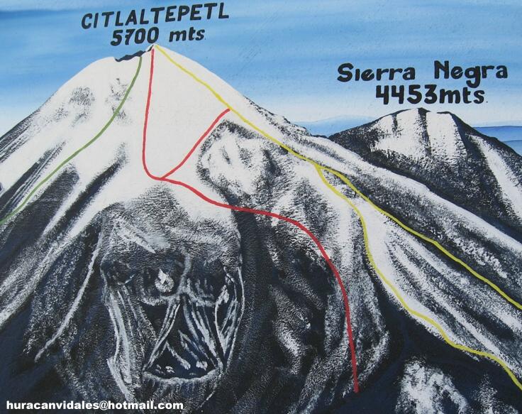
The second prominent feature within the park is a 4600 meter volcano named Tliltepetl, or Volcan Sierra Negra, whose crater is at slightly less than 7 km distance of the Citlaltepetl crater. The young Citlaltepetl and the old Tliltepetl nowadays constitute a joint geological structure.
Geology
The 100th anniversary volume of the bulletin of the Mexican Geological Society
contains a review of the geology and eruptive history of some of the most
important Mexican volcanoes, including Pico de Orizaba. A more specific
recent work on the geology of Citlaltepetl is contained in the thesis of Andrea
Rossotti. Pico de Orizaba is the main peak in the volcanic chain going
from Cofre de Perote to Las Cumbres, Pico de Orizaba and Sierra Negra.
This chain is part of the "Faja Volcanica Transmexicana", a series of volcanic
chains in the 2 km high plateau of central Mexico, which itself covers a
sizeable fraction of the Mexican territory and population of the country.
Citlaltepetl stands some 3 km above this plateau, and over 4 km relative to. The saddle between
both mountains clearly shows above the inversion layer.
The lava tongue descending
from Pico de Orizaba towards Sierra Negra, with a deposition of
alluvions at its base, is the most noticeable red feature.
the Eastern low lands of Veracruz.
Citlaltepetl has a complex eruptive history dating back to the formation
of the cone of Torrecillas, 650,000 years ago. The present Pico de Orizaba
volcano formed about 16,500 years ago inside a previous structure known as
Espolon de Oro.
According to Sierra Negra is an older structure formed
through two episodes of activity, the first 600,000 years ago and the second,
named the ”Orizaba episode”, some 240,000 years ago.
Three major explosive events occurring 4,100 years ago are related to
the destruction of a mountain dome and the formation of the present crater,
formed by a symmetric oval crater of 500m×400m . An impressive ”lava
tongue” spanning 4 km SW in the
direction of Sierra Negra is the result of a more recent episode of activity
dated 1566. Most recent minor activity episodes occurred in the XVI
century, although minor activity has been reported from time to time and
the volcano is now considered as active in a period of quietness .
Nowadays Citlaltepetl presents weak SO2 exhalations and low level tremors.
Seismological monitoring is performed by station of the CENAPRED
The National Park Pico de Orizaba was established by a presidential
decree of December 16, 1936, signed by Lazaro Cardenas.
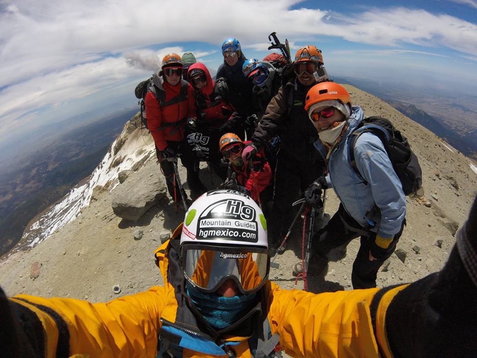
Video climbing el Pico de Orizaba, clic on the picture up
Legend - Name
Citlaltepetl, ”the mountain of the stars” in Nahuatl language,
The Aztecs believed that the divine fire from Orizaba's crater consumed a great winged serpent, Quetzalcoatl. Then Quetzalcoatl, the god of learning and the priesthood, took the form of a man and sailed across the sea, swearing to return and seek vengeance on the Aztec nation.
From the summit there is an excellent view of other mountains, such as, Iztaccihuatl, Popocatépetl (an active volcano,) la Malinche, and Cofre de Perote.
The base shelter can be reached using 4x4´s to weave through a forest of coniferous trees. Above the shelter there is a an area that is ideal for camping for those who require greater acclimatisation to altitudes exceeding 4000 m. By way of the north route the ascent crosses a glacier known as Jamapa, which leads to the crater. From the crater it is necessary to ascend to the summit by circling the cone-shaped apex.
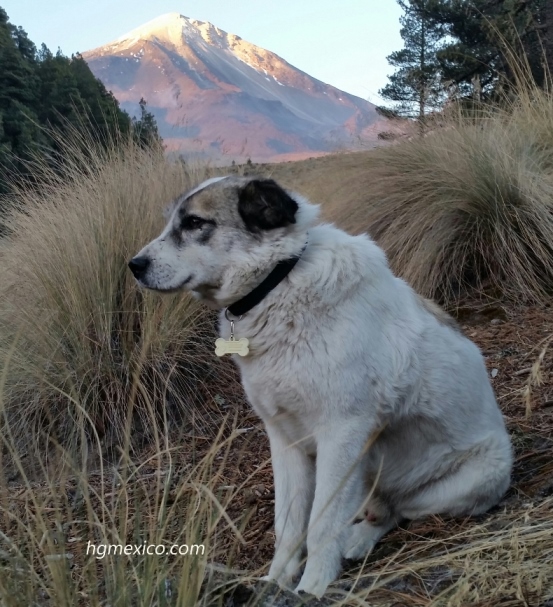
The famous dog Citla , this dog has rescue lost people at the mountain, some time climb at the summit with the climbers
Pico de Orizaba , photos and video hgmexico
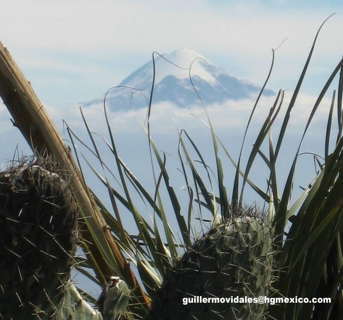
Pico de Orizaba west face
Video : Climbing el Pico de Orizaba
Pico de Orizaba South - east feace
The north face for older way for climb Pico de Orizaba , now is better climb South Face
Pico de Orizaba Video in rainning time
Contact Us (more information):